Patrick Cooney
Friday, July 31, 2015Do you electrofish and monitor aquatic habitat variables? Of course you do… it basically defines what you do in the field!
Smith-Root is teaming with Lowrance (makers of BioBase, a simple to use online habitat monitoring platform), to provide fisheries scientists a free year of vegetation, substrate, and bathymetric mapping services to help you save time and money while boat electrofishing (and improve accuracy too!).
“We take out the Smith-Root electrofishing boat, hit a button to passively collect habitat data while electrofishing, upload the file, get it back in less than 24 hours, and make a difference. This is incredibly simple,” says Kevin Johnson, a fisheries scientist with the Florida Fish and Wildlife Conservation Commission (FWC), about the integration of Smith-Root and BioBase technologies.
Across the fisheries science field, electrofishing and habitat monitoring activities are almost exclusively conducted independently. This inefficient method increased the amount of time and resources spent in the field. Further, the accuracy of habitat assessments is often called to question because of subjective visual measurement techniques.
Fisheries biologists and aquatic habitat specialists began asking the question: “Can aquatic habitat data collection and electrofishing surveys be simultaneously conducted in a way that increases accuracy and efficiency in the field?”
Up until recently, biologists with FWC “determined habitat variables, like aquatic vegetation density, with visual estimates after electrofishing transects were completed. Because visual surveys are taken with the eye from above the water surface, it is difficult to assess the accuracy of those estimates,” says Kevin Johnson.
In response, FWC began using BioBase in 2012 to assess aquatic vegetation while electrofishing with their Smith-Root electrofishing boat.
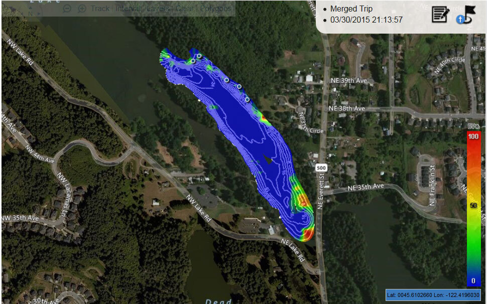
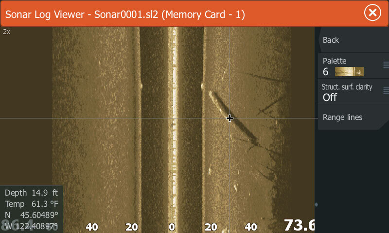
FWC biologists use a Lowrance HDS Depth Finder/GPS Chartplotter to passively collect sonar data while electrofishing. Upon returning to the research station, the FWC scientists uploaded their sonar data to BioBase where it was quickly processed by cloud-based servers to create interactive maps and standardized reports of aquatic vegetation biovolume (% of water column occupied by vegetation), bottom substrate hardness, and bathymetric maps that corresponded with electrofishing transects.

Aquatic vegetation abundance information recorded passively to a SD card on a Lowrance HDS while electrofishing on Lacamas Lake, WA. Additionally, largemouth bass catches were captured by the boat captain and later uploaded to BioBase and overlayed on the map. Now both fish and objective habitat information can be collected together with little additional work. See the report here.
Kevin Johnson says, “This coupling of fish and habitat information has been so valuable that I am taking this boat statewide to map lakes. This is transforming the way that we conduct our long term monitoring program that tracks changes over time in aquatic vegetation and fish metrics.”
The interactive habitat maps and reports are used to relate fish metrics, like fish density or species richness, to vegetation composition and bottom substrates. The interactive maps can also be used to formulate informed herbicide application plans and accurate vegetation control measures.

The globally recognized Invasive Plant Management team with FWC is using the information from these reports to formulate accurate herbicide application plans that save time and money. These reports take the guesswork out of your task and increase confidence in your data.
Perhaps most importantly, the maps and data can instantly be shared with the public with easy to understand reports that are generated with one click of a button. Biologists are finding that these simple click-of-a-button generated reports are of tremendous value not only to the science, but also to lake residents and anglers alike.
“I can quickly demonstrate the value of my project using the maps and reports that can be shared with the public”, says Johnson.
Smith-Root, the world leader in electrofishing science, and BioBase, an industry leader in aquatic vegetation mapping, have closely monitored the successful pairing of this equipment by fisheries scientists.
We are pleased to announce that all Smith-Root electrofishing boat customers, both new and old boats, who have Smith-Root outfit their boats with an HDS Lowrance system will receive a one year complimentary subscription to BioBase.
Please come and see Smith-Root’s outfitted electrofishing boat at the American Fisheries Society meeting in Portland, Oregon in August 2015 to see this integrated equipment. An interactive demonstration will be given by representatives from Smith-Root and Lowrance at 2:00PM on Tuesday, August 18th on the boat in the trade show area.